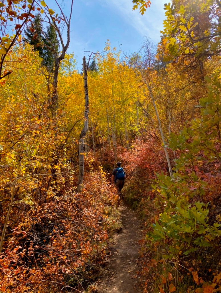
It’s fall, and we all want to get out to enjoy the vibrant colors of the season. No matter which area of the Utah you are in, you can find beautiful autumn colors to enjoy. Whether you prefer the comfort of your car or an afternoon out on the trail, this is the post for you!
If you live along the Wasatch Front, you can’t go wrong visiting any canyons that bisect the mountain range. Check out this interactive Fall Foliage Predictor Map to ensure the best color. This post will list all areas starting at the north end of the state and then move progressively south.
Utah’s Best Fall Hikes and Drives
Logan Canyon (US-89)

Drive the 41 miles from Logan to Bear Lake to enjoy orange and red Maples and bright yellows of Aspen clinging to the near vertical limestone cliffs. You can enjoy a picnic amid falling leaves at one of five picnic sites, Dewitt being one of my favorites. You can also stroll or bike on the river trail for a more leisurely pace. If hiking is more your speed, there are dozens to choose from. The most popular are Wind Caves (4 miles RT) and Crimson Trail (4.7 miles loop), with views of the canyon that will take your breath away if the climb hasn’t already. Tony Grove has picnic sites nestled next to a lake ($ 10-day use fee) with a short one-mile hike that circumnavigates the water.
Monte Cristo Highway (Highway 39)
Definitely one of the lesser-known scenic highways. A drive through this 67-mile stretch, you see the brilliant colors of Aspens, Oaks, and Maple. You’ll pass by Pineview Reservoir, nestled under the peaks of Powder Mountain and Snowbasin ski resorts, then continue the trek following the South Fork of the Ogden River. If you travel the road from mid to late September, take the short side trip to Causey Reservoir, probably the most scenic reservoir in the state. Hike the Skull Crack to see the Kanokee salmon run.
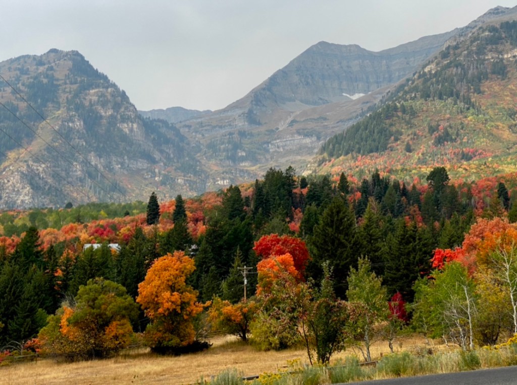
Big Cottonwood Canyon over Guardsman Pass to Midway (Highway 190)

Ever since Guardsman Pass was paved in the fall of 2018, this drive has become an increasingly popular trek to experience fall colors. The drive up the canyon is bursting with color. As you crest the pass, you are treated to views reaching as far as the Uinta mountain range and Wyoming on a clear day. The spectacular drive doesn’t end there because you can continue your drive down towards Midway and Wasatch Mountain State Park.
Best Fall Color Hikes in Big Cottonwood Canyon
Big Cottonwood Canyon is a mecca for hiking with its many trailheads. Some of the most popular trails are great choices for leaf peeping, but you really can’t go wrong with any of them. The Silver Lake trail (1-mile loop) is accessible for all abilities and has picnic sites and bathrooms. Other popular trails include Lake Blanche ( 7 miles RT – hard), Donut Falls (1.5 miles RT – easy), and Willow Lake (2.8-mile loop – moderate).

Pro tip: No dogs are allowed (even in your cars) in either Big or Little Cottonwood Canyon because of the watershed. Nearby Millcreek canyon is a great choice to bring along your pup.
Alpine Loop and Cascade Springs (State Road 92)
This glacial carved canyon covering 27 miles from American Fork Canyon to Provo Canyon offers vibrant fall colors contrasting with evergreen trees nestled below the iconic Timpanogos Mountain. This is arguably the most popular scenic drive in Utah for fall colors and is definitely worth the hype. If you plan on driving through, there is no fee, but if you plan to stop to picnic or hike, there is a $6 fee or free with the America the Beautiful Pass. Also, the road is very narrow with some tight turns, so vehicles over 30 feet are not recommended.
Some great stops along the way are Timpanogos Cave National Monument (reservations recommended), Cascade springs (7.5-mile detour) rated for all abilities, Sundance Ski Resort for lift rides and other activities, and Bridal Veil Falls, which has an all-accessible paved path (in Provo Canyon). The Alpine loop is a popular hiking destination with many trails. I recommend Stewart Falls (3.4 miles RT – moderate) and Primrose Overlook (3.6 miles RT – moderate).
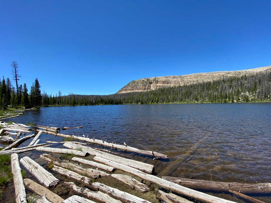
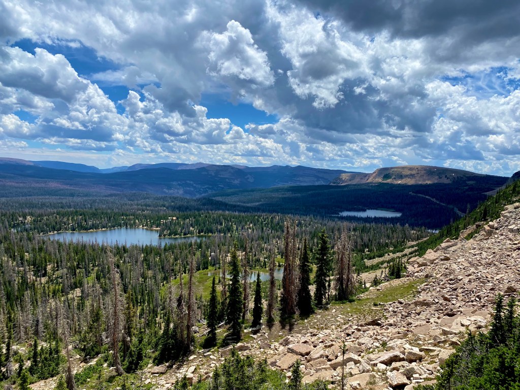
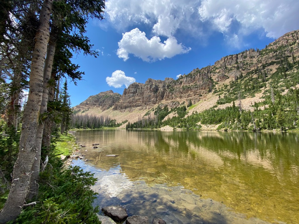
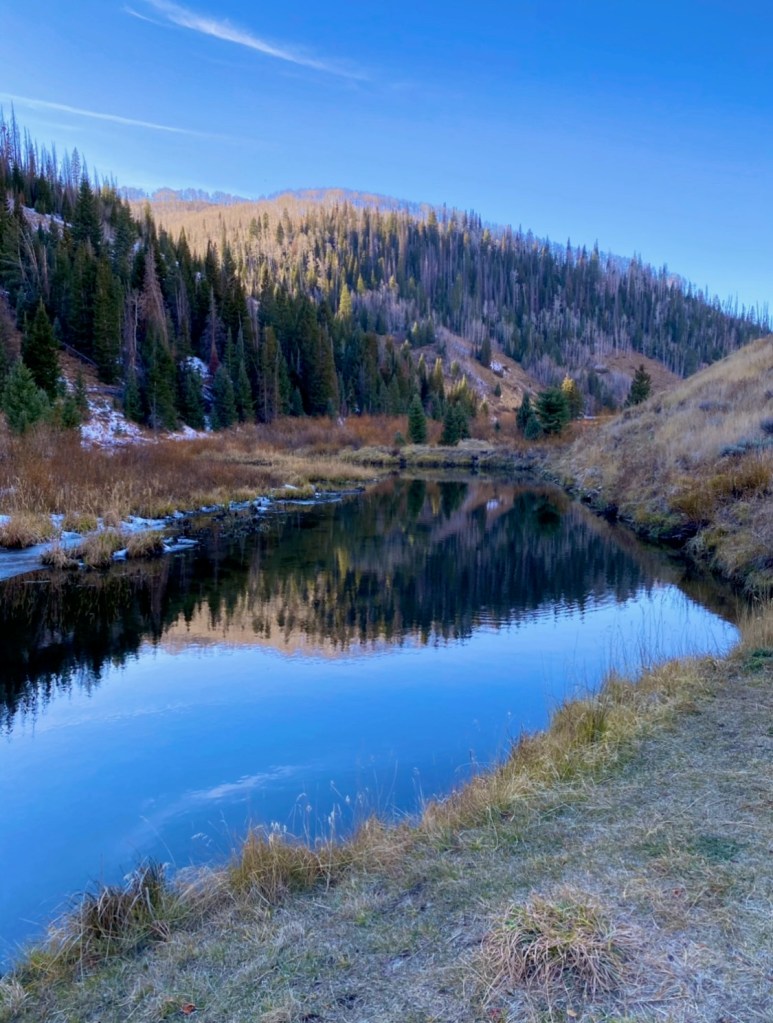
Mirror Lake Highway (Highway 150)
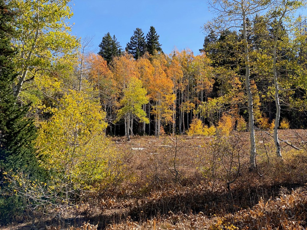
This road bisects the Uinta mountain range from Kamas, UT to Evanston, WY, and is known for its many alpine lakes, many of which are accessible right off the main road. It may be chilly, but you can take a canoe or kayak out on the water to enjoy the aspens clinging to the sides of the surrounding peaks. Provo River Falls is a great scenic stop located about 23.5 miles from Kamas. Great easy walks include the signature Mirror Lake trail (1.5 miles around the lake) and the Crystal Lake trail (.3 miles). Looking for a little more challenge. Hike the short but steep trail to the summit of Bald Mountain (3 miles RT) for a birds-eye view of the area.
Mount Nebo Loop (Forest Road 015)

This scenic byway runs 38 miles around the Wasatch Front’s tallest peak. Witness the contrasting colors of Oak with Junipers and Aspens, along with Spruce and Fir. Take the time to enjoy the scenic pullouts, and definitely don’t miss the Devil’s Kitchen scenic overlook, which is like a mini-Bryce Canyon. Also of note are the Gotto Falls hiking trail (.6 miles RT) and Payson Lakes.
State Highway 25 to Fish Lake
Home to the world’s largest organism, the aspen tree Pando. This colony of aspen trees originated from one seed and has over 40,000 trees with a shared root system. It makes for some amazing yellow and gold quaking leaves in autumn. Continue the drive to the lake and the overlooks to enjoy the vistas of Thousand Lakes, Boulder, and the Henry Mountains.
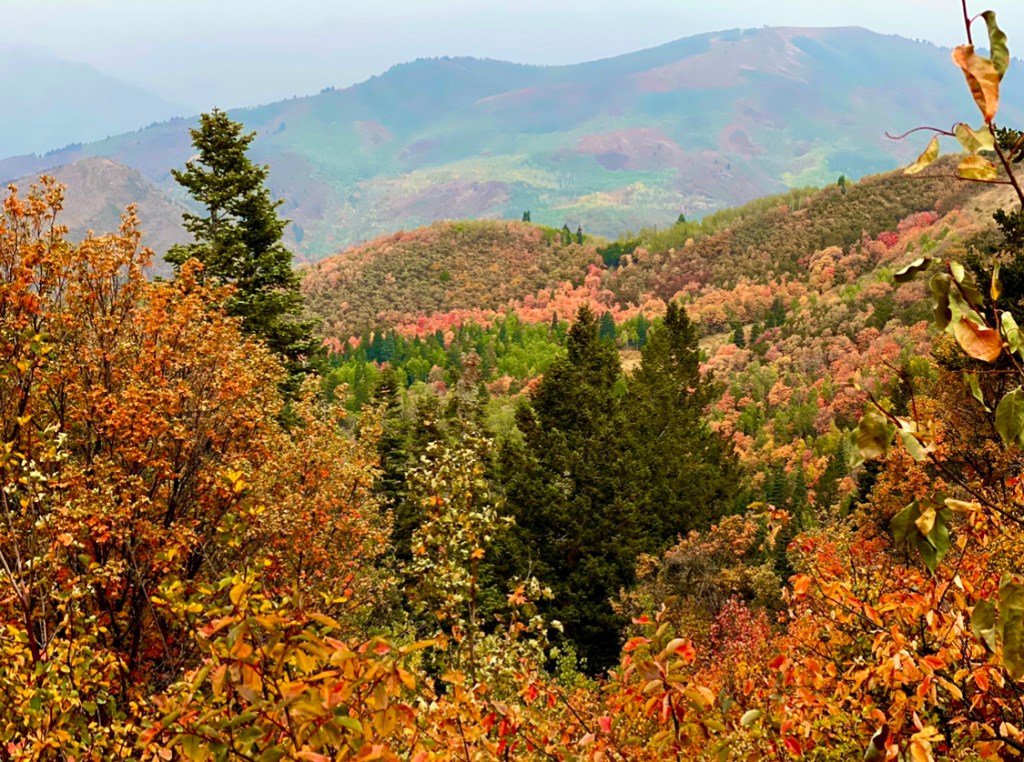
Huntington Canyon (State Highway 31)
This canyon is mainly known for its fishing, camping, and ATV trails. Its real gem is the access to Skyline Drive, a dirt, high clearance 4WD or ATV road that sits at 10,000 ft and affords 360 views for 80 miles! That’s a lot of fall colors. The best hike recommendation is the Gordon Falls trail (2.5 miles RT).

La Sal Mountains
Eight miles south of Moab, take a left at the La Sal mountains scenic byway loop sign. You’ll travel a narrow, winding road for 60 miles (no RVs or trailers). Enjoy the yellow quaking aspens and the orange and reds of Gambel Oak. Take in the views on trails such as Squaw Springs trail (8.6 miles RT), Hazard County (6 miles RT), or the Warner to Oowah Lake (4 miles RT). As you descend the mountain, stop at the desert overlook to take in the views of Canyonlands NP and Moab.

All American Road: Highway 12
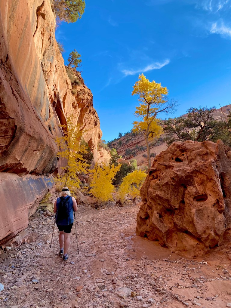
Known as an all-American road and touted by many as the most scenic drive, fall colors are not the first thing that comes to mind when thinking about this drive. You can take in stellar shows of aspens driving over Boulder mountain and the showy cottonwoods down in some of the lower elevations of the drive. Calf Creek Falls (6 miles RT) has brilliant golds, and Pine Creek Box Canyon near Escalante is a riparian oasis with reds, oranges, and yellows (9 miles through hike).

Highway 14 From Cedar City to Long Valley
Drive this 41 miles of gold and yellow aspens contrasting with verdant green spruces and pines. Make sure to stop and have a picnic with views at Navajo lake, Strawberry Point (which actually overlooks a red rocks amphitheater), or take a detour to Cedar Breaks National Monument. All afford incredible views and the changing colors of the high alpine forest.

So which scenic drives have you done, and which ones would you like to try? Let me know in the comments.
Looking for more fall adventures? Check out my post about Capitol Reef National Park.