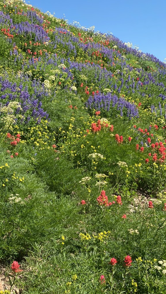
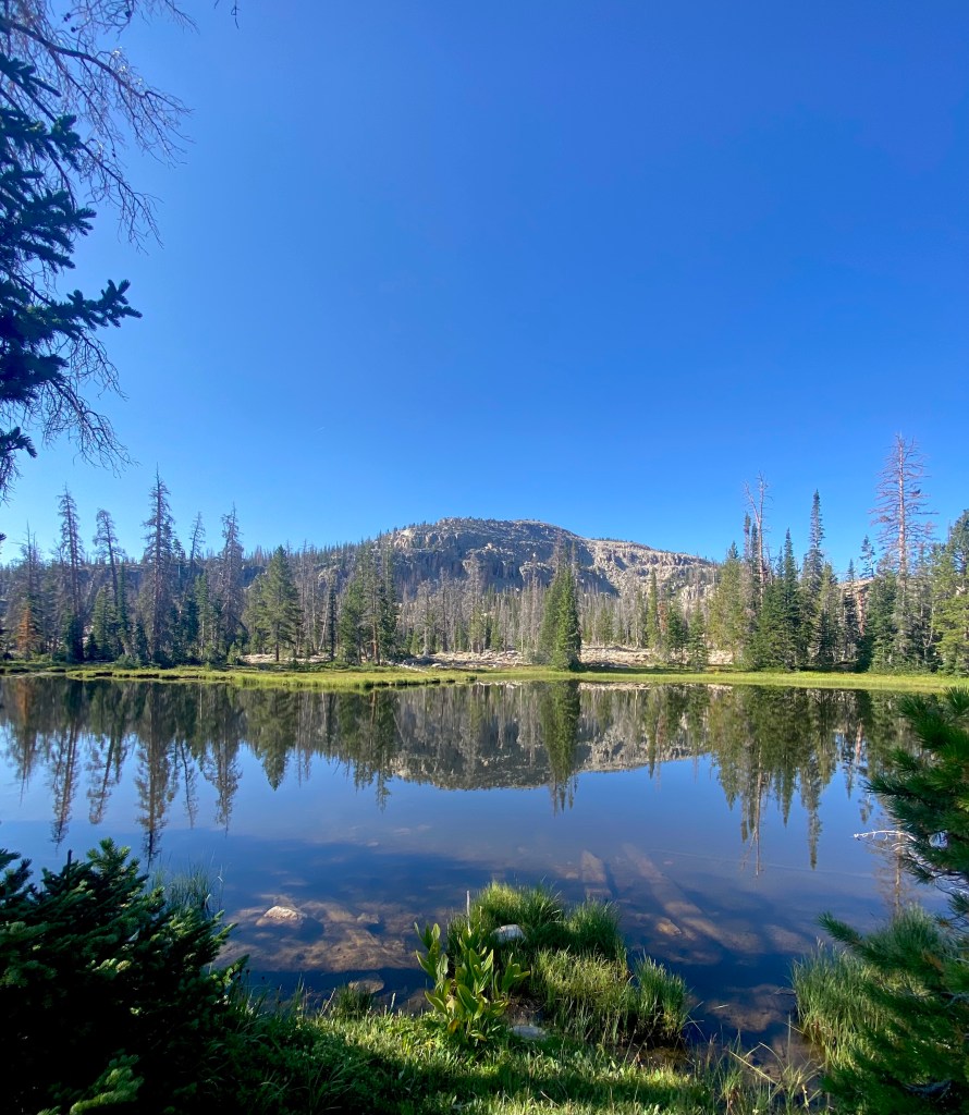
The meadows in the Canyons above Salt Lake City burst with Wildflowers during July.
Nestled amidst the breathtaking landscapes of Utah, Salt Lake City is an outdoor enthusiast’s paradise. With its proximity to the towering peaks of the Wasatch Mountains, this vibrant city serves as a gateway to a myriad of incredible hiking trails. Whether you’re a seasoned hiker or a beginner looking to explore nature’s wonders, Salt Lake City has something for everyone. In this blog post, we’ll unveil the ten best hikes near Salt Lake City, where awe-inspiring vistas, serene alpine lakes, showy wildflowers, and pristine wilderness await.
******This post contains affiliate links. If you click on one of them, I may receive a small commission at no extra cost to you. Thank you!
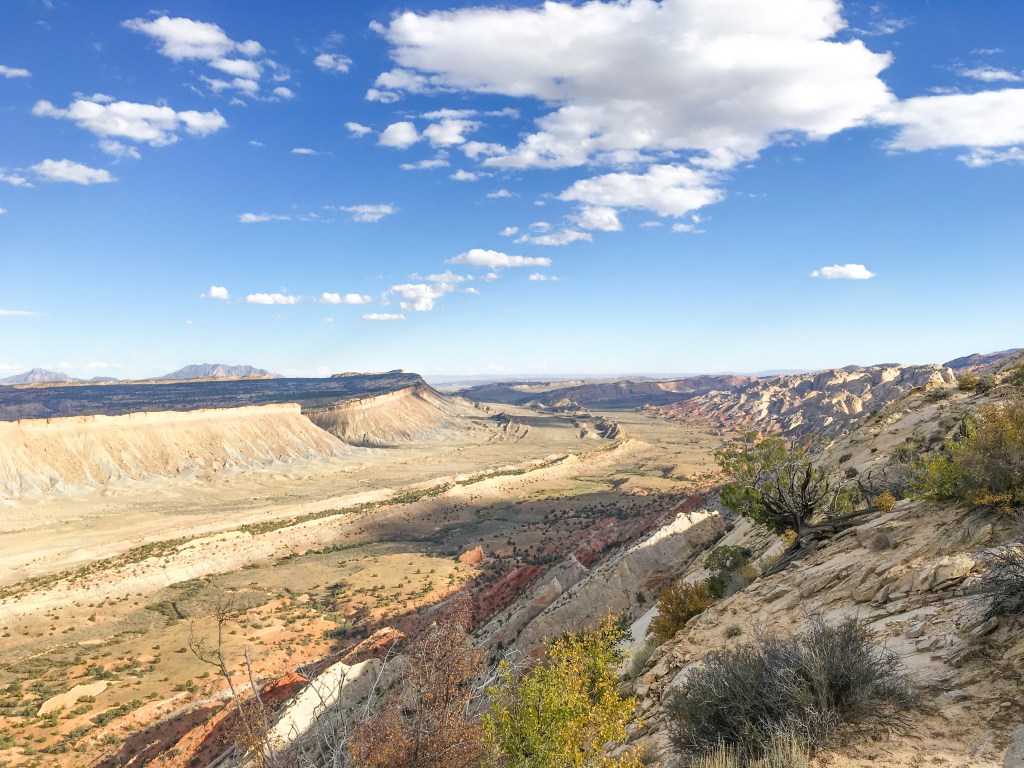
High Elevation Peaks in Little Cottonwood Canyon
Prepare For Your Hike
Whether you’re a seasoned hiker or just starting to explore the trails for the first time, being prepared can help you hit the trails with confidence.
You can prepare by researching your trail and local conditions using apps such as Duoveo and reading the comments about current trail conditions.
But most importantly, you can prepare by carrying the 10 essentials in your pack.
A First Aid Kit
Hydration (always bring more than you think you need)
Food (bring all the snacks to keep your energy up on the trail)
Safety: Flashlight or Headlamp, fire kit, and whistle
Layers of clothes (to combat whatever weather conditions bring)
Knife or multi-tool
Navigation (map, GPS, compass)
Sun Protection ( I always carry sunscreen, sunglasses, and a hat or visor)
Emergency shelter (I’ve been hiking for over 20 years and just started carrying a bivy, essentially a space blanket shaped like a sleeping bag, a few years ago)
Toilet paper and trowel or, better yet, Wag Bags.
Personally, I always bring my hiking poles with me as well.
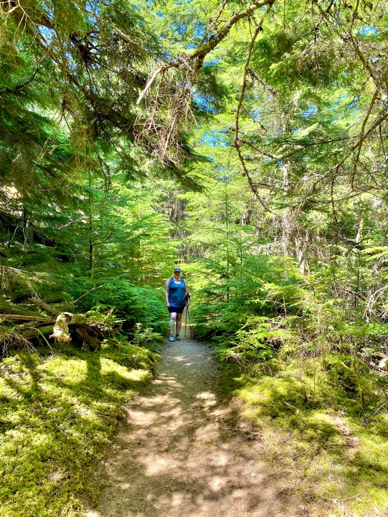
Hiker on the Albion Meadows trail en route to Cecret Lake.
Recreate Responsibly
There are seven Leave No Trace that you need to know before you hit the trails. It’s more than just packing out your trash. If you’d like to know more, go to Leavenotrace.org
1. Plan Ahead and Prepare
2. Travel and Camp on Durable Surfaces
3. Dispose of Waste Properly
4. Leave it as you found it.
5. Minimize Campfire Impact.
6. Respect Wildlife.
7. Be Considerate of Others.
10 Best Hikes Near Salt Lake City, Utah
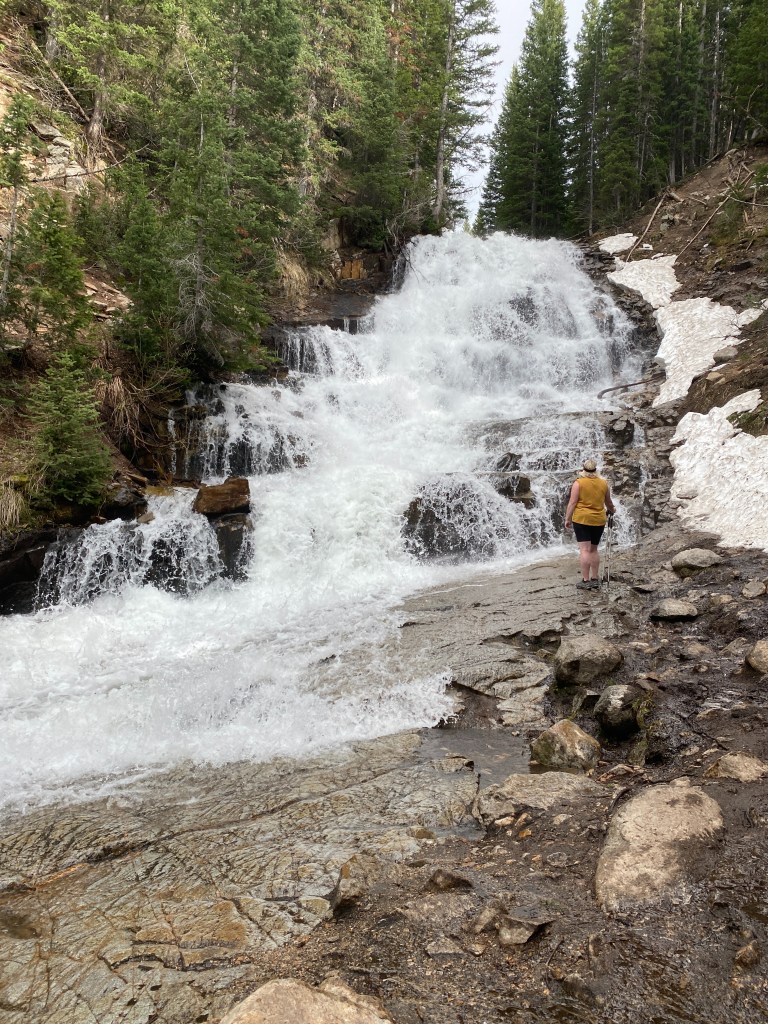
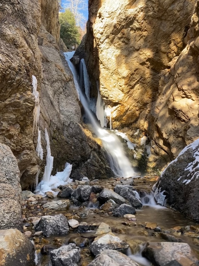
Bell Canyon Trail to Lower Falls
Lower Bell Canyon Waterfalls are a cool retreat on a hot summer day.
This trail has more than just the falls: after less than a mile of hiking with valley views, a beautiful tree-lined reservoir comes into view. After you pass the reservoir and go through a meadow, you cross the creek and enter the pine-filled craggy granite canyon. The final quarter-mile climbs steeply before you are rewarded with a cool respite under the falls opposite another beautiful view of the Oqquirh Mountains and the Salt Lake Valley.
Trailhead: Granite Trailhead
Distance: 5.1 miles roundtrip with 1,492 ft. elevation gain – Moderate
Other Trail Information: Bathrooms at the trailhead. No dogs because of the watershed.
Battle Creek Falls
Bask in the mist of Battle Creek Falls. Watch your step on the slippery rocks.
For a shorter, family-friendly hike, head to Battle Creek Falls. Situated in Pleasant Grove, just outside Salt Lake City, this trail features a charming waterfall cascading into a rocky canyon. The hike is relatively easy, making it accessible for hikers of all ages and skill levels.
Trailhead: Dead End of Battle Creek Drive in Alpine, Utah.
Distance: 1.6 miles roundtrip with 606 ft. gain (for both the top and bottom of falls)
Other Trail Information: Bathrooms are available at the trailhead; dogs are permitted.
Cecret Lake
Keep your eyes out for the salamanders swimming in Cecret Lake.
Nestled near the top of breathtaking Little Cottonwood Canyon, Cecret Lake (yes, spelled with a “c”) is a family-friendly hike to a picturesque mountain lake. The trail is particularly enchanting during the summer months when vibrant wildflowers carpet the meadows. Take in the tranquil beauty of the lake, look for salamanders, but don’t touch them, and enjoy a picnic amidst nature’s splendor.
Trailhead: Cecret Lake Campground Trailhead at the top of Little Cottonwood Canyon.
Distance: 1.8 miles roundtrip with 465 ft. elevation gain
Other Trail Information: $10 amenity fee (goes towards road and trailhead maintenance)
Bathrooms at the trailhead. No dogs because of the watershed. Access to this trail typically opens in the beginning of July.
Lake Blanche
Sundial Peak reflections in the glassy waters of Lake Blanche.
This picturesque beauty is the quintessential Salt Lake City Hike. You ascend the steep trail to witness the towering Sundial Peak reflected in this stunning alpine lake. Make sure to save time to visit the nearby Lilian and Florence Lakes with their breathtaking vistas, and pristine waters. Unfortunately, swimming is NOT permitted due to watershed regulations.
Trailhead: Mill B trailhead is about 4.5 miles up Big Cottonwood Canyon.
Distance: 7 miles roundtrip with 2,811 ft. elevation gain
Other Trail Information: Bathrooms at the trailhead. No dogs or swimming due to watershed regulations. This is a very popular hike. Go early for the best reflections and solitude.
Brighton Lakes Loop
Taking in the views above Lake Mary on the Brighton Lakes Trail
This is one of my favorite hikes to do in summer for the wildflowers. Depending on which route you take you have the option to see up to 7 alpine lakes. The are many route options that move from family-friendly to larger miles with some mild scrambling over boulders fields. No matter the option you choose, you’ll finish with that mountain-high feeling of being immersed in a beautiful setting with magnificent views. Typically July is best for wildflowers. Make sure to keep your eyes peeled as this is a popular area for moose. I once saw seven on the same hike!
Trailhead: Base of Brighton Ski Resort at the top of Big Cottonwood Canyon.
Distance: 3 Options:
Lake Mary 2.6 miles roundtrip with 849 ft. elevation gain
Brighton Lakes Trail 4.4 miles with 1243 ft. elevation gain
Brighton Lakes Loop 7 miles with 1807 ft. elevation gain
Other Trail Information: There are no bathrooms at the trailhead but nearby at Silver Lake. Due to watershed regulations, dogs and swimming are prohibited. This is a very popular hike.
Grandeur Peak
Cloud inversion from Granduer Peak high above the Salt Lake Valley
Sitting in the heart of Mill Creek Canyon, Grandeur Peak makes for a perfect summit for beginners and sunset watchers (Just make sure to bring your headlamp!) It beckons hikers with its challenging yet rewarding climb. As you ascend, you’ll be treated to awe-inspiring views of the valley and the surrounding mountains. Reaching the summit offers a sense of accomplishment and panoramic vistas that make the effort worthwhile.
Trailhead: Top of Church Fork in Millcreek Canyon (East Trailhead)
Distance: 5.9 miles roundtrip with 2,365 ft. elevation gain
Other Trail Information: Bathrooms at the trailhead. Dogs permitted. $5 fee for Millcreek Canyon
Lackawaxen Lake
Reflections and Soltitude at Lackawaxen Lake
Nestled in a bowl below Clayton Peak, Lackawaxen Lake offers a pristine alpine retreat for hikers. This moderately challenging trail leads through beautiful forests, across meadows, adorned with wildflowers, and finally to the shimmering lake itself. Enjoy the peaceful ambiance and take a moment to soak in the serene beauty of the surroundings. This trail sees less traffic because most people stop at Bloods Lake, the first you encounter on this beautiful trail.
Trailhead: Bloods Lake Trailhead just past Guardsman Pass at the top of Big Cottonwood Canyon
Distance: 7.6 miles roundtrip with 1,696 ft. elevation gain
Other Trail Information: Bathrooms at the trailhead. Dogs on leash permitted, however they are not allowed in the lakes.
Mount Van Cott
June super blooms, city, and Wasatch Range views from the Mount Van Cott Trail.
Conveniently located in Salt Lake City itself, Mt. Van Cott provides an excellent opportunity for a quick, challenging, and rewarding hike. The trail leads to the summit of this prominent peak, offering panoramic views of the cityscape and the surrounding mountains. It’s the perfect hike to fit into a busy schedule without compromising on the natural beauty. May and June are prime season for wildflowers.
Trailhead: Top of Red Butte Canyon Road (paid parking) or free at Popperton Park
Distance: 2.7 miles roundtrip with 1,227 ft. elevation gain my favorite open but from the paid lot.
4.8 miles roundtrip with 1,650 ft gain from Popperton Park
Other Trail Information: No bathrooms at the trailhead. (Port-a-potties at the park). Dogs on leash permitted,
Wasatch Crest Trail
July Wildflowers on the Wasatch Crest Trail in Big Cottonwood Canyon
Definitely one of my personal favorites, the Wasatch Crest trail keeps me coming back time and time again. This renowned and breathtaking high-elevation trail begins from the top of Guardsman Pass and is relatively easy for the length of the trail because of the net downhill. This iconic trail traverses the ridge line, offering awe-inspiring panoramic views of the Wasatch and Uinta Moutain ranges, the Great Salt Lake, and Antelope Island. Hikers and mountain bikers alike are treated to an unforgettable adventure in this alpine paradise.
Desolation Lake and the Wasatch Range from the Crest Trail
Trailhead: Bloods Lake Trailhead just past Guardsman Pass at the top of Big Cottonwood Canyon
Distance: Options (both require a shuttle vehicle)
10.8 miles with 1,312 ft. elevation gain (finish at Mill D North Trailhead)
13.7 miles with 1,801 ft. elevation gain (finish at the top of Millcreek Canyon)
Other Trail Information: There are bathrooms at the trailhead. Dogs are not permitted. This trail is popular with mountain bikers.
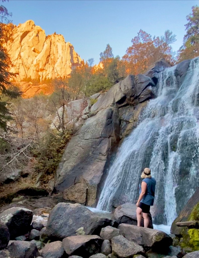
Upper Farmington Canyon
Upper Farmington Waterfall
Hiking Upper Farmington Canyon is a whole adventure! It is also locally known as the Car Graveyard hike because of the 6+ car wrecks that can be found hidden in the trees along the trail. They toppled from the road high above. Some of the wrecks are probably from the early 1900s. Also on this trail is a small cave, two creek crossings with smaller cascades, and some epic views of the valley and Antelope Island! Make sure you follow the social paths after the creek crossing so you don’t miss any wrecks. All that in the 1 1/2 miles before you even reach the falls! You’ll hear the falls near the trail’s end before you see them. New in 2023 are switchbacks in the steep hillside to reach the falls. No more sketchy rope making this a truly family-friendly trail.
Trailhead: First hairpin turn on Farmington Canyon Road
Distance: 3 miles roundtrip with 948 ft. elevation gain
Other Trail Information: No bathrooms. Dogs Permitted
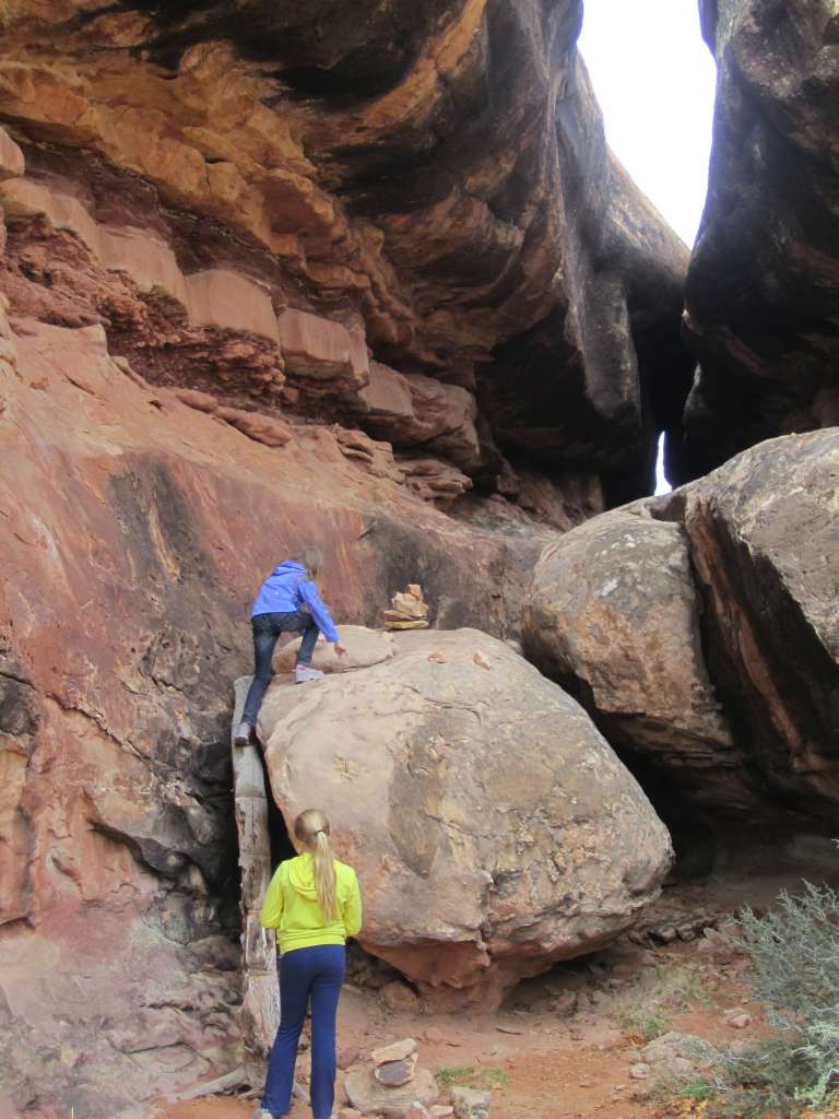
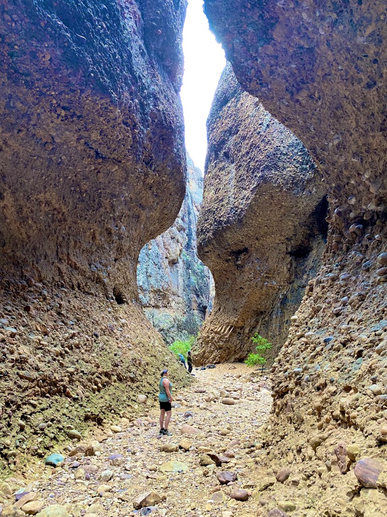
Following the cairns in Elephant Canyon (Canyonlands National Park – Needles District)
******This post contains affiliate links. If you click on one of them, I may receive a small commission at no extra cost to you. Thank you!
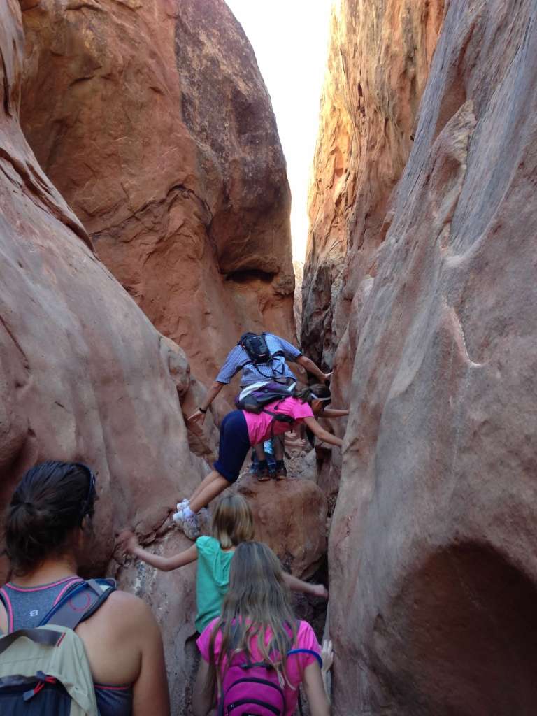
Hiking as a family was one of the most looked forward to, and rewarding activities as our kids were growing up. Utah is one the best places to find hikes to do with kids, especially when you are just beginning to have them hike on their own. Whether your kids are 2 or 12 (or older), It’s never too late to get out on the trails as a family. In this post, you’ll find 26 Family-Friendly Utah hikes and all you need to get out on the trails that will have your kids asking when is the next time you’ll go for a hike.
Zebra Canyon Grand-Staircase-Escalante National Monument
Tips for your Family-Friendly Adventure
Change Your Mindset
Remember that the first few times out on the trail will set the precedent for how enjoyable your little ones will think hiking is. You need to be ok with not hiking at your usual pace and let your child(ren) be excited about being in nature. The hike will become just as much about the journey as it will be about the destination. Let them take the time to investigate that hidey-hole on the side of the trail, check out the stream, or examine the bugs or other wildlife. Take breaks as needed. Bringing along friends is always a good idea. It helps the miles sail by.
Sheets Gulch-Capitol Reef National Park
Plan
You want your first experiences to be a success, so plan on a trail well inside your child’s capabilities. They will leave feeling proud of themselves for reaching the goal and see the joy of reaching a cool destination. When selecting a hike for novice hikers, what they experience on the journey should excite them to see more. I always look for trails with water features (streams, ponds, waterfalls, and best of all, swimming holes), cool places to explore like arches, caves, old car wrecks or ruins, or anything that provides that sense of discovery for your kids.
Pleasant Creek – Capitol Reef National Park
Prepare
Really this goes for any hike, but when you are hiking with kids, even a slight discomfort can turn into a big deal. Especially if they are already out of their comfort zone.
When hiking, always be sure to pack the Ten Essentials. Not only are these important for emergencies, but they make great tools or motivators on the trail.
Navigation (map and compass) We have these features on our phones. Using an app like Alltrails can even enable us to follow our progress on the trail. Kids enjoy tracking their progress, and if you bring a paper map and compass, they might even enjoy playing the explorer and following the trail. Maybe even put them in charge of being the navigator.
First Aid Kit Nothing will derail a family-friendly hike more than a scrape or cut that doesn’t receive the proper care of a bandaid.
Sun Protection Don’t forget sunscreen, lip balm, hats, and sunglasses.
Headlamp or Flashlight Not only is one of these good to have in case of emergency, but they can be great motivators to have your child flash the light on cool things they find out on the trail or to explore tiny nooks.
Nutrition Not only will this keep their energy up, but fun snacks are always a great motivator!
Hydration. Always bring more than you need. Find what worked best for you. Some people prefer water bottles, others hydration reservoirs with tubes so you can sip along the way. Regardless, it’s always a good idea to have your child help carry their own snacks and water so they can access them easily. the added benefit for littles is this makes them feel so grown up carrying their own backpack.
Matches or firestarter
Multitool or knife
Extra Clothing Make sure you have a jacket in case the weather suddenly turns, and it starts to rain, or the wind picks up.
Emergency Shelter A bivy is a space blanket shaped like a sleeping bag. You can get these for about $5 on amazon.
Jenny’s Slot Canyon in Snow Canyon State park is a perfect first-time adventure at .3 miles.
Teach Responsible Stewardship
As we enjoy all these beautiful places, we want to teach the next generation to recreate responsibly so we can care for the land and they remain pristine. Teach your children to stay on the trail, pack out all trash and waste, respect wildlife, and don’t mark up trees or rocks or pick the wildflowers. You can learn more about the seven principles of Leave no Trace at lnt.org
A beautiful tree-lined reservoir comes into view after less than a mile of hiking with valley views. The loop around the reservoir will take you through aspen forest, with a bridge crossing over.
Trailhead: Granite Trailhead
Distance: 2.4-mile loop with 495 ft. elevation gain
Other Trail Information: Bathrooms at the trailhead. No dogs because of the watershed.
Best Seasons: Year-round Spikes are suggested for winter hiking.
The joy of this hike is it starts at a park. Nothing like some playground time at the end of a hike to motivate the littles on the return. Other highlights along the way include a wooden bridge over Little Willow Creek, a Rock Tunnel, and sweeping views of the Salt Lake Valley, Antelope Island, and the Oqquirh Mountains. Alternatively, a shorter route starts the Orsen Smith Trailhead but is steeper and doesn’t have the fun features of the Bonneville Shoreline Trail route.
Trailhead: Hidden Valley Park in Draper, Utah
Distance: 3.3 miles RT with 508 ft. elevation gain
Other Trail Information: Bathrooms at the trailhead. No dogs because of the watershed.
Best Seasons: Fall and Spring. It can be really hot in summer unless you go early when the mountain shades the trail.
Donut Falls
Donut Falls from within the cave
This is arguably one of the most popular trails in the area for a good reason. This family-friendly gem pays off with a scenic river and beautiful cascades after a relatively easy hike. Caution and experience are advised if you choose to navigate up the slippery rocks to enter and view the falls coming through the “donut hole” hole in the small cave-like dome.
Trailhead: Mill D North off Hwy 190 in Big Cottonwood Canyon
Distance: 3 miles roundtrip with 498 ft. elevation gain
Other Trail Information: Bathrooms at the trailhead. Dogs are not permitted.
Upper Farmington Canyon
Caution is advised if you use the rope to go to the Upper Farmington Canyon Falls base.The 2nd Car Wreck is my favorite.
Hiking Upper Farmington Canyon is a whole adventure! It is also locally known as the Car Graveyard hike because of the 6+ car wrecks that can be found hidden in the trees along the trail. They toppled from the road high above. Some of the wrecks are probably from the early 1900s. Also on this trail is a small cave and two creek crossings with smaller cascades! Make sure you follow the social paths after the creek crossing, so you don’t miss any wrecks. All that in the 1 1/2 miles before you even reach the falls! You’ll hear the falls near the trail’s end before seeing them. Going to the base of the falls requires negotiating a steep hillside with the aid of a rope. Proceed at your own risk.
Trailhead: First hairpin turn on Farmington Canyon Road, Farmington, Utah
Distance: 3 miles roundtrip with 948 ft. elevation gain
Other Trail Information: No bathrooms. Dogs Permitted.
Best Season: Year-round. Add 2 miles in winter because the gate is closed.
Lisa falls
Lisa Falls in June
Lisa falls is accessible to just about anyone. At a mere .3 miles for the road, you can bring a picnic and make an afternoon out of it. What makes these falls so fascinating is the sharp turn the water takes part way down and then how the water divides and cascades down the rock. One side of the fall gushes, and the other just slides down the rock. It’s just mesmerizing to watch.
Trailhead: Opposite the Little Cottonwood Creek Trailhead up between mileposts 6 and 7 in Little Cottonwood Canyon. Park on the left side of the road.
Distance: .3 miles round trip with 121 ft elevation gain
Other Trail Information: No swimming or wading, or dogs (watershed). No bathrooms at the trailhead.
Best Season: Best viewed in spring while runoff is flowing but open until Mid November. Never hike this in winter because of avalanche danger.
Paper Airplane Trail
Paper Airplane Trail
What could be cooler than Top of the world views and a larger-than-life paper airplane sculpture?
Trailhead: Just off Horizon Run Road at the Powder Mountain Ski Resort in Eden, Utah
Distance: 1-mile loop with 246 ft. elevation gain
Other Trail Information: No bathrooms at the trailhead.
Best Season: Late June to End of September
Gloria Falls
Multi-tiered Gloria Falls
Gloria Falls is also located in Little Cottonwood Canyon. Another local favorite, you won’t have the trail to yourself, but it’s a favorite for a good reason, and you don’t want to miss it. You’ll first descend a short walk down to the river and cross a bridge over the roaring Little Cottonwood Creek. Then you’ll climb for about a mile, where you’ll see signs right before the trail appears to a dead end at the creek. Just past the sign for White Pine Lake, you’ll see a sign for Red Pine Lake. Follow that trail over the bridge and immediately take a left, following the social trail to the falls.
Trailhead: Park in the White Pine Trailhead 5.3 miles up Little Cottonwood Canyon
Distance: 2.8 miles round trip with 584 ft. elevation gain
Other Trail Information: No swimming or wading or dogs (watershed). Bathrooms at the trailhead.
Best Season: Spring through Fall. The Falls become buried by snow in the winter.
Ruth Lake
Reflections on Ruth Lake
Ruth Lake is the perfect hike for families. At only two miles roundtrip, everyone can enjoy the satisfaction of reaching a destination after only one mile of hiking. Once you reach the lake, you can enjoy the day on the water, fishing, floating, hanging in your hammock, and even having a picnic before heading back to your car, blissed out by your afternoon spent by this alpine lake.
Trailhead: Ruth Lake Trailhead off Highway 150, 35 miles east of Kamas.
Distance: 2 miles RT with 285 ft. elevation gain.
Other Trail Information: Bathrooms, Dogs are permitted on leashes. $6 Fee or free with your National Parks Pass.
Best Season: Highway 150 typically opens in mid-June until the snow falls (Check with UDOT for up top date conditions)
Tony Grove Lake Nature Trail
Tony Grove Lake
Tony Grove Lake Nature Trail is just bursting with wildflowers at peak season. The trail is a little rocky and trickier to negotiate for a short section on the far side of the lake. Come for the day and bring a picnic. There are six picnic sites in the area. You can also float or fish on the water after your hike!
Trailhead: Tony Grove Lake Day Use Area in Logan Canyon
Distance: 1.3 miles loop with 59 ft elevation gain.
Other Trail Information: Bathrooms, Dogs are permitted on leash. $10 Fee or free with your National Parks Pass.
Best Season: Opens in July until the snow falls.
Moonshine Arch
Moonshine Arch
Moonshine Arch really has it all for kids some small caves, a grotto, and a fun echo, and they can walk on top of the arch! (Watch your littles on this one. It’s narrow up there) make sure to plan plenty of time for this one because once the kids get there, they’ll want lots of time to explore.
Trailhead: 6.5 miles outside Vernal pullout off Highway 191. Use directions from Alltrails or this brochure.
Distance: 2 miles roundtrip with 252 ft. gain
Other Trail Information: No bathrooms at the trailhead. Dogs are permitted. I suggest bringing a downloaded map or the brochure because the trail is not marked.
Best Season: Spring or Fall Can hike in summer or winter. Just be prepared for the weather and trail conditions.
Battle Creek Falls
Be sure to stand under the spray at Battle Creek Falls.
This hike is moderate difficulty but short. You’ll know you’re almost there after the wide path crosses the footbridge. After you enjoy the falls from the base, make sure you take the trail to the top of the falls for the incredible view of the valley and Utah lake below.
Trailhead: Dead End of Battle Creek Drive in Alpine, Utah.
Distance: 1.6 miles roundtrip with 606 ft. gain (for both the top and bottom of falls)
Other Trail Information: Bathrooms are available in the nearby park; dogs are permitted.
Best Season: Year-round. Early spring is best for wildflowers and big flows. Bring spikes in winter.
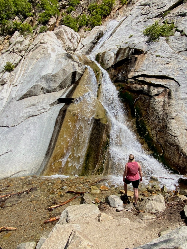
Stewart Falls
Do you see me standing at the base of the first tier of Stewart Falls?
Another crowd-pleaser of a hike, this trail rolls through aspen groves and pines with views of majestic Mount Timpanogos and the Sundance Ski Resort before you round the bend to view the 200-foot, two-tiered cascade. After you enjoy the overlook, proceed down the switchbacks for an up-close view of these spectacular falls. The kids love to play in the spray of the falls.
Trailhead: Aspen Grove Trailhead or Ride the lift at Sundance Ski resort and take their trail.
Distance: 3.4 miles roundtrip with 930 ft. elevation gain
Other Trail Information: $6 forest service fee (or free with your national parks pass),
Bathrooms at the trailhead. Dogs permitted.
Best Season: Spring is best for wildflowers and big flows. Hiking in winter is not advised due to avalanche danger.
Wall Lake
Wall Lake is popular with families for paddling and cliff jumping.
Wall lake is named after the tall Granite Wall lining one side of the lake. A shelf on this wall is popular with cliff jumpers (at your own risk). It is also a popular spot for fishing, kayaking, and stand-up paddle boards because of its large size and mountain views, and clear water.
Trailhead: Park at the Crystal lake trailhead off Hwy 150. (Make sure to follow the sign to Wall lake since this parking area has multiple trailheads.)
Distance: 2.5 miles roundtrip with 147 ft. elevation gain
Other Trail Information: $6 forest service fee (or free with your national parks pass),
Bathrooms at the trailhead. Dogs permitted.
Best Season: Whenever Hwy 150 opens (typically mid to late June) until the snow flies. Usually October.
Silver Lake Loop
Autumn at Silver Lake
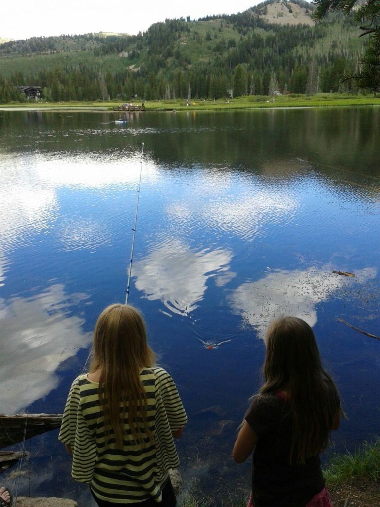
Probably the best thing about hiking the Silver Lake Loop (Besides the gorgeous views, water, and wildlife sightings) is the accessibility. Besides the boardwalk, a wide, packed gravel makes this trail appropriate for those with mobility issues. Enjoy your walk around the water and stay to fish, extend your hike to other nearby lakes, enjoy the naturalist displays in the visitors center, anus use one of the picnic sites for lunch. The tiny Brighton store just across the street sells food and ice cream if you are looking for a post-hike treat!
Fishing at Silver Lake
Trailhead: Silver Lake Visitors Center at the top of Big Cottonwood Canyon.
Distance: .9 miles roundtrip with 55 ft. elevation gain
Other Trail Information: Bathrooms at the trailhead. Picnic tables. No dogs because of the watershed.
Best Season: June-October. Winter for snowshoeing and cross-country skiing.
Cecret lake
Fireweed blooms and mountain reflections at Cecret Lake
Cecret lake (Yes, it’s spelled that way) is not a secret, but this popular hike is worth the effort for the beautiful lake that sits hidden in a bowl surrounded by breathtaking mountain peaks. Keep your eye out for moose on the trail and salamanders in the water.
Trailhead: Cecret Lake Campground Trailhead at the top of Little Cottonwood Canyon.
Distance: 1.8 miles roundtrip with 465 ft. elevation gain
Other Trail Information: $10 amenity fee (goes towards road and trailhead maintenance)
Bathrooms at the trailhead. No dogs because of the watershed.
Best Season: July through September (when the road to the trailhead is open.)
Southern Utah Hikes
Corona Arch
Corona Arch is every bit as impressive as Delicate Arch, but 1/3 of the miles.
Not only is Corona arch a kid-friendly hike, but you don’t need to obtain a timed-entry permit to see it because it is outside Arches National Park. You’ll climb ladders and moki steps (steps carved into the rock) and across a wide sandstone shelf and two “smaller” arches to reach this impressive arch.
Trailhead: Corona Arch Trailhead 10 miles down Hwy 279.
Distance: 2.5 miles RT with 482 ft elevation gain
Other Trail Information: No fees, Toilets across the street at the gold bar campground. Dogs on leash permitted.
Best Season: Year-round but hot in summer.
Kanab Sand Caves
Kanab Sand Caves is a Child’s playground.
These manmade caves have 6 arch openings to views of the surrounding area. Kids love the scramble up the sandstone to access the caves.
Trailhead: Pullout off Hwy 89, five miles north of Kanab.
Distance: .5 miles RT with 124 ft elevation gain
Other Trail Information: No fees, Dogs on leash permitted.
Best Season: Year-round but hot in summer. Can be icy in winter.
Red Reef Trail
Negotiating the Moki Steps with the aid of a rope on the Red Reef Trail.
This short hike has slot sections, Moki steps, and alcoves to explore, and feels like a playground amid the red rock of Southern Utah. After storms, there may be waterfalls and water in the water pockets like the one pictured above. It’s hot here in the summer, so if you choose to visit, go early.
Trailhead: Day Use Parking area in the Red Cliffs Campground. The campground is found in the Red Cliffs Conservation area 15 minutes north of St. George, Utah.
Distance: 2.2 miles RT with 223 ft elevation gain
Other Trail Information: $5 fee payable by cash or check or free with a national parks pass, Toilets across at the campground. Dogs on leash permitted.
Best Season: Year-round but hot in summer.
Maple Box Canyon and Arch
Towering walls and rock climbers await in Mable Box Canyon.
These are two different hikes, but they are both short and close, so plan to tackle them on the same day. Fall is a gorgeous time to visit, with red and orange leaves against the rock walls. These hikes are fascinating because, unlike the usual sandstone walls in a slot or an arch, these features or made of multicolor conglomerate rock!
Trailhead: Day-use parking area up Maple Canyon near Fountain Green, Utah, for the Arch. Make sure to take the Middle Fork trail. There is an unmarked pullout about 1 mile up Maple Canyon for the Maple Box Canyon.
Distance: Maple Canyon Arch: 1.6 miles RT with 580 ft elevation gain, Maple Box Canyon 1 mile RT with minimal gain.
Other Trail Information: $5 fee payable by cash or check or free with a national parks pass, Toilets at the Middle Fork Trailhead. Dogs on leash permitted.
Best Season: Year-round but hot in summer.
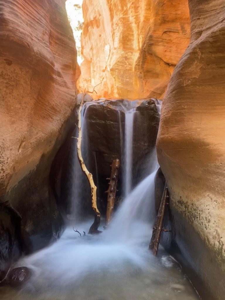
Kanarra Falls
Upper Falls in the Kanarra Slot Canyon.
The first time I hiked this canyon was during a family reunion before the hike was permitted. There were 20 of us, and the youngest was 4. Once we got past the initial section of the trail and to the water, the kids practically ran up the trail. They loved walking through the water and “discovering” what was around the next bend between the towering red rock walls. Make sure you have sturdy hiking or water shoes. And never enter a slot if there is a chance of flood. Check the local weather here.
Trailhead: End of 100 North in Kannaraville, Utah
Distance: 3.7 miles RT with 753 ft elevation gain
Other Trail Information: $12 permit per person (part of the fees benefit Utah schools!) You can obtain the permits here. Plan ahead. They go fast. Please make sure to read all the notices on the website carefully. No dogs
Best Season: Year-round but hot in summer. Not advisable in winter.
Sheets Gulch/Slot
This hike is an adventure for kids. They love finding the petrified would strewn throughout the canyon and there are fun obstacles to climb as you proceed up the canyon. Located off the Notom Road in Capitol Reef National, Sheets Gulch is a long one, but you can just hike as long as you think your group would enjoy it and then return the way you came.
Trailhead: Signed pull-out 21.5 miles down Notom Road
Distance: 13.8 miles RT with 757 feet elevation gain
Other Trail Information: No fees, no toilets, no dogs (but loads of adventure!)
Best Season: Year-round but hot in summer. The best times are Spring and Fall.
Strike Valley Overlook
On a clear day, you can see all the way to Lake Powell from the Strike Valley Overlook.
Even the drive to get to this trailhead is a beautiful adventure. There are three arches along the spur road so have the kids see who can spot them first. Once you arrive at the trailhead, follow the signs to the Strike Valley Overlook. Look for the cairns (stacked rocks) that mark the trail. Please, please, please stay on the trail so as not to destroy the cryptobiotic soil. Its an important organism for the desert ecosystem. Also, don’t build cairns. It can cause other hikers to lose the trail and get lost.
Trailhead: End of Upper Muley Twist Spur Road (4WD with high clearance advised) off the Burr Trail Road.
Distance: .6 miles RT with 100 ft elevation gain. If you need to walk the spur road it’s 6.2 miles.
Other Trail Information: No fees, No toilets or water. No dogs.
Best Season: Year-round but hot in summer.
Cohab Canyon
Cohab Canyon is nature’s playground for kids.
Cohab Canyon has some stellar overlooks over Capitol Reef National Park, hoodoos, and short-side slot canyons. It’s a playground for kids to climb and explore. Don’t forget to stop at the historic Gifford Farmhouse afterward for homemade pies and ice cream.
Trailhead: Cohab Canyon has two trailheads. If you have two vehicles, I would park one at each end, then start at the trailhead across from the Park Campground, do the short climb, then all downhill to the Highway 24 trailhead (1.5 miles). If you only have one car park in the Hickman Bridge parking lot off Highway 24, hike uphill while the kids’ legs are fresh. When you reach the top of the trail, take in the views but don’t go down to the campground trailhead. Return the way you came.
Distance: As a through hike (with 2 cars), 1.5 miles with 574 ft gain or 3 miles RT with 794 ft elevation gain.
Other Trail Information: Bathrooms at the Hickman Bridge trailhead. No dogs.
Best Season: Year round
Mill Creek Waterfall and Swimming hole
Swimming in Millcreek Canyon (Moab)
Head up the canyon. Cross the stream a few times and be prepared to get wet swo=imming at this oasis in the desert below the falls. (Keep an eye out for poison ivy.)
Trailhead: Dirt pull-out at the end of Powerhouse Lane in Moab, Utah Directions here.
Distance: 1.8 miles RT with 65 ft elevation gain
Other Trail Information: No fees, No vehicles longer than 22 ft down the road to the trailhead. Dogs on leash permitted.
Best Season: Year-round but hot in summer.
Lower Calf Creek Falls
Make sure to wear your swimsuits to take a dip in the swimming hole at the base of Lower Calf Creek Falls.
Six miles round trip is long but doable for most kids. Just make sure it is not their first hike! To reach this swimming hole oasis under the 126 ft falls, you hike 3 miles (one way) following the creek under the towering sandstone walls. Interpretive signs along the route draw your attention to the area’s flora, fauna, and history. It’s always fun for the kids to hunt for the signs to see who can find the next one first. Keep an eye out for the Pictographs! You know you’re getting close when the trail begins to surround you with greenery. The trail is sandy much of the way, so don’t forget to bring your swimsuit. You’ll want to enjoy a cool dip after this warm hike.
Trailhead: Park in the lot near the Calf Creek Campground off UT-12, 11 miles south of Boulder and 15 miles east of Escalante ($5 fee). Go early. The lot fills up quickly.
Distance: 6.7 miles with 866 ft elevation gain.
Other Trail Information: Dogs on leash permitted. Bathrooms at the trailhead.
Best Season: Year-round. But it can be cold in winter.
So which hike would you like to try first? I’d love to hear why in the comments.
Looking for more Utah Gems, check out my Ultimate Insider’s Guide to Capitol Reef National Park. It’s our favorite Utah National Park and has so many kid-friendly hikes!
Did you know that Utah has more than 100 waterfalls? It may not be the first thing you think of in a place world-renowned for its rock formation-filled national parks, but there are myriads of great cascade-filled hikes just waiting for you to chase those falls. So scroll down to read about more than 16 of the best waterfall hikes in Utah. You don’t want to miss a single one.
What to wear on a Waterfall hike
Lower Calf Creek Falls
I just love the feeling of the cooling mist on my face after hiking to a waterfall. Still, while you may be warm or even hot while on your hike, the area around a waterfall may be significantly cooler because of the water and Utah’s low humidity. It’s a good idea to bring layers such as a lightweight, long-sleeved shirt or a waterproof jacket when hiking to Utah’s waterfalls.
No one likes to get a blister out on the trail, so waterproof hiking shoes can make or break your experience. If you are hiking trails like Kanarra Falls, when walking through is unavoidable, a good neoprene hiking sock with either a sandal in warmer weather or shoes in cooler weather will keep your feet from getting too cold. As always, when out on the trail, you always want to pack your ten essentials.
Kanarra Falls
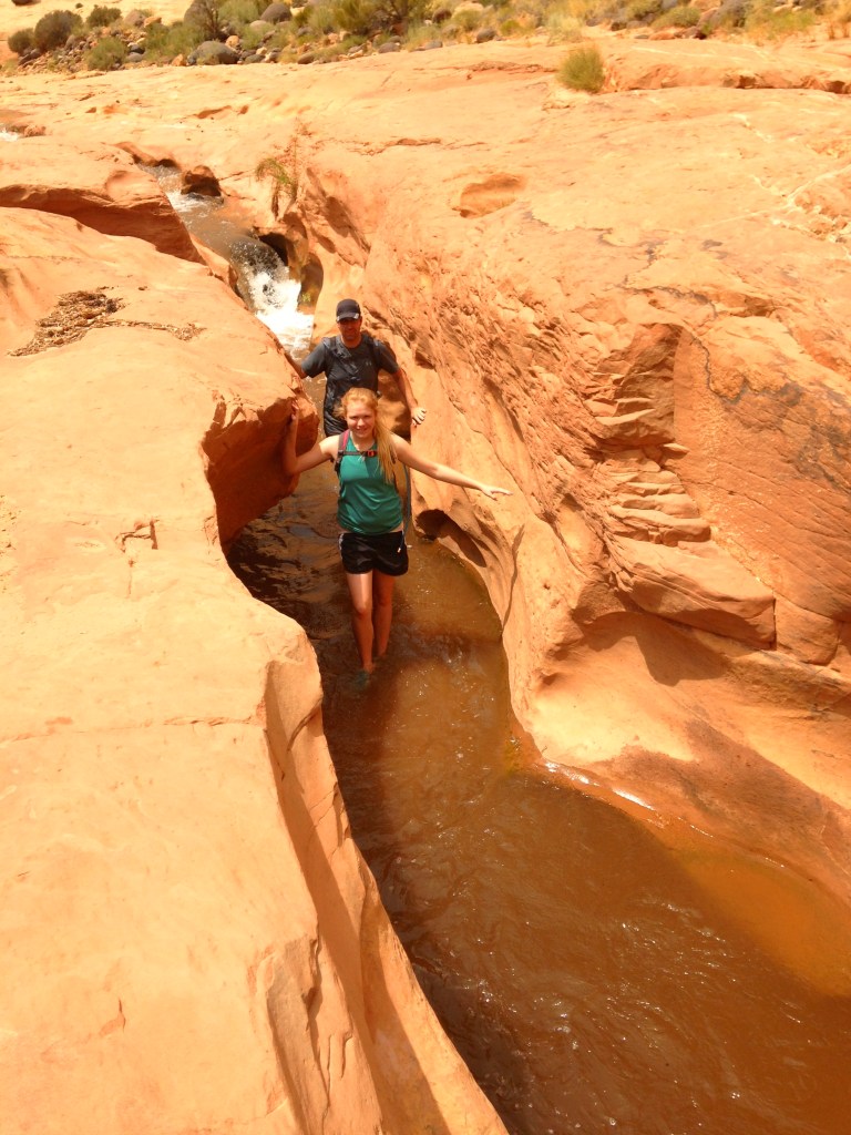
The Best Waterfall Hikes in Utah
Now on to the good stuff! Please remember as you are exploring the outdoors to Leave No Trace so these places can remain pristine and enjoyable for you and everyone. Not familiar with the seven principles of Leave No Trace, you can learn more about Leave No Trace here.
Bell Canyon Lower Falls
Craggy cliffs glow during golden hour above Lower Bell Canyon Falls.
This trail has more than just the falls: a beautiful tree-lined reservoir comes into view after less than a mile of hiking with valley views. After you pass the reservoir and go through a meadow, you cross the creek and enter the pine-filled craggy granite canyon. The final quarter-mile climbs steeply before you are rewarded with a cool respite under the falls opposite another beautiful view of the Oqquirh Mountains and the Salt Lake Valley.
Trailhead: Granite Trailhead
Distance: 5.1 miles roundtrip with 1,492 ft. elevation gain
Other Trail Information: Bathrooms at the trailhead. No dogs because of the watershed.
Best Seasons: Year-round, but spring has the largest flows.
Donut Falls
Donut Falls
This is arguably one of the most popular trails in the area for a good reason. This family-friendly gem pays off with a scenic river and beautiful cascades after a relatively easy hike. Caution and experience are advised if you choose to navigate up the slippery rocks to enter and view the falls coming through the “donut hole” hole in the small cave-like dome.
Trailhead: Mill D North off Hwy 190 in Big Cottonwood Canyon
Distance: 3 miles roundtrip with 498 ft. elevation gain
Other Trail Information: Bathrooms at the trailhead. Dogs are not permitted.
Upper Farmington Canyon Falls
Upper Farmington Canyon Falls in Spring.
Hiking Upper Farmington Canyon is a whole adventure! It is also locally known as the Car Graveyard hike because of the 6+ car wrecks that can be found hidden in the trees along the trail. They toppled from the road high above. Some of the wrecks are probably from the early 1900s. Also on this trail is a small cave and two creek crossings with smaller cascades! Make sure you follow the social paths after the creek crossing so you don’t miss any wrecks. All that in the 1 1/2 miles before you even reach the falls! You’ll hear the falls near the trail’s end before you see them. Going to the base of the falls requires negotiating a steep hillside with the aid of a rope. Proceed at your own risk. As of 2023, there are new, safer switchbacks down the hill to the falls.
Trailhead: First hairpin turn on Farmington Canyon Road
Distance: 3 miles roundtrip with 948 ft. elevation gain
Other Trail Information: No bathrooms. Dogs Permitted
Best Season: Year-round. Add 2 miles in winter because the gate is closed.
Lisa Falls
These unique falls cascade part way and then take a sharp turn on the Cliff.
Lisa falls is accessible to just about anyone. At a mere .3 miles for the road, you can bring a picnic and make an afternoon out of it. What makes these falls so fascinating is the sharp turn the water takes part way down and then how the water divides and cascades down the rock. One side of the fall gushes, while the other side just slides down the rock. It’s just mesmerizing to watch.
Trailhead: Opposite the Little Cottonwood Creek Trailhead up between mileposts 6 and 7 in Little Cottonwood Canyon. Park on the left side of the road.
Distance: .3 miles round trip with 121 ft elevation gain
Other Trail Information: No swimming or wading or dogs (watershed). No bathrooms at the trailhead.
Best Season: Best viewed in spring while runoff is flowing but open until Mid November. Never hike this in winter because of avalanche danger.
Gloria Falls
The many tiers of Gloria Falls really gush in spring.
Gloria Falls is a family-friendly hike also located in Little Cottonwood Canyon. Another local favorite, you won’t have the trail to yourself, but it’s a favorite for a good reason, and you don’t want to miss it. You’ll first descend a short walk down to the river and cross a bridge over the roaring Little Cottonwood Creek. Then you’ll climb for about a mile, where you’ll see signs right before the trail appears to dead end at the creek. Just past the sign for White Pine Lake, you’ll see a sign for Red Pine Lake. Follow that trail over the bridge and immediately take a left following the social trail to the falls.
Trailhead: Park in the White Pine Trailhead 5.3 miles up Little Cottonwood Canyon
Distance: 2.8 miles round trip with 584 ft. elevation gain
Other Trail Information: No swimming or wading or dogs (watershed). Bathrooms at the trailhead.
Best Season: Spring through Fall. The Falls become buried by snow in the winter.
Lower Calf Creek Falls
Would you take a dip in the swimming hole below Lower Calf Creek Falls?
Many consider Lower Calf Creek Falls the Jewel of Grand Staircase-Escalante National Monument. To reach this swimming hole oasis under the 126 ft falls, you hike 3 miles (one way) following the creek under the towering sandstone walls. There are interpretive signs along the route drawing your attention to the area’s flora, fauna, and history. Keep an eye out for the Pictographs! You know you’re getting close when the trail begins to surround you with greenery. The trail is sandy much of the way, so don’t forget to bring your swimsuit. You’ll want to enjoy a cool dip after this warm hike.
Trailhead: Park in the lot near the Calf Creek Campground off UT-12, 11 miles south of Boulder and 15 miles east of Escalante ($5 fee). Go early. The lot fills up quickly.
Distance: 6.7 miles with 866 ft elevation gain.
Other Trail Information: Dogs on leash permitted. Bathrooms at the trailhead.
Best Season: Year-round. But it can be cold in winter.
Upper Calf Creek Falls
The green oasis at Upper Calf Creek Falls.
If solitude is more your jam and you’re an experienced hiker, you might prefer Upper Calf Creek Falls. Although the hike is shorter, the trail descends quickly down for a mile before reaching the falls. Follow the cairns. After enjoying the 86 ft tall falls (watch out for poison ivy), ascend the side trail up to the smaller cascade and deeper pools above the main falls.
Trailhead: Head north from pull off the side road on your left just after milepost 81. Follow the road to the parking area.
Distance: 2.1 miles with 695 ft elevation gain.
Other Trail Information: Dogs on leash permitted.
Best Season: Year-round. But it can be cold and icy in winter.
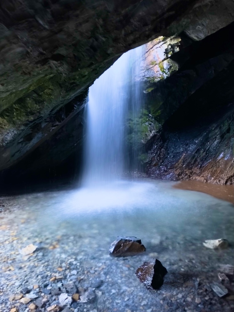
Hidden Falls
Hidden Falls in Winter.
This trail is accessible to most because of the distance. This hidden grotto really is a treat, so don’t miss it.
Trailhead: Mill B (right by the Lake Blanche Trailhead)
Distance: .3 miles roundtrip with 49 ft elevation gain (I highly recommend continuing another mile to the overlook of Big Cottonwood Canyon and the Salt Lake Valley below.)
Other Trail Information: Bathrooms at Lake Blanche Trailhead nearby. No Dogs.
Best Seasons: Year-round.
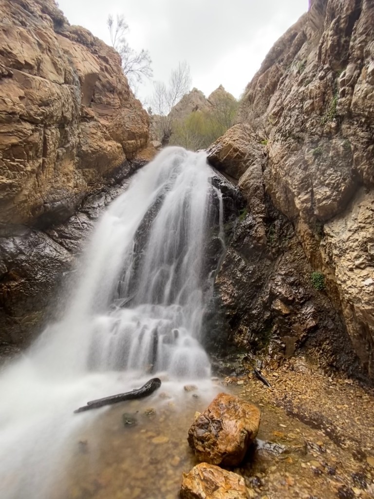
Adam’s Canyon Waterfall
Enjoying the cooling mist of Adam’s Canyon Falls.
Located in Kaysville, just off Highway 89, you start this hike in full sun before you enter the canyon and follow the stream all the way to the falls. Despite climbing steeply at times, this trail is a local favorite. If you prefer solitude on the trail, make sure to hike this one early. These 40-foot falls are reliably beautiful year-round. If you want to know more about hiking this one in the winter, check out my post about the 8 Best Frozen Waterfalls in Northern Utah post. This is a great one for those who like to hike with their dogs.
Trailhead: Adams Canyon Trailhead (Looks like a big park and ride lot)
Distance: 4.2 miles roundtrip with 1,358 ft. elevation gain.
Other Trail Information: No bathrooms at the trailhead. Dogs permitted.
Best Seasons: Year-round.
Little Deer Creek Falls
Climbing up the side of Little Deer Creek Falls.
Located adjacent to Cataract Gorge, Little Deer Creek Falls stands over 100 feet tall! The Cataract Gorge is full of swimming holes (bring your swimsuit) that make for a perfect summer retreat in the high Uintas mountains. This really is one of the most beautiful places in the Uintas. While not unknown, it is much quieter than many other places off Highway 150. If you have high clearance 4×4, you can drive right up to this area. Otherwise, it requires a 7-mile roundtrip hike adjacent to the Jeep road. It is well worth the effort for this gorgeous spot. Bonus: If you love camping, there are many great dispersed camping spots in this area. To access the falls, take FR 137 and then FR 027 until you arrive. You can’t miss it.
Trailhead: Park at the Junction of FR137 and FR 027 (there are pullouts)
Distance: 7.5 miles RT with 1,200 ft elevation gain (you climb up on the way out)
Other Trail Information: $6 or free with your America the Beautiful parks pass. Dogs Permitted. There are no Bathrooms at the trailhead but some at the turn-off to FR137.
Best Season: Starting July through September. Before that, the water is too high, and it’s dangerous.
Archangel Falls
Archangel Falls
The cascading crimson steps of North Creek are located below the legendary Subway in Zion National Park. Consider yourself one of the lucky ones if you’re able to secure a permit to hike this gorgeous canyon under the 500-foot tall walls. Read more about the Subway Hike here.
Trailhead: You’ll obtain directions to the trailhead from the permit office.
Distance: 9.1 miles with 1,305 ft. elevation gain for the entire Subway trail. This is a Hard hike.
Other Trail Information: $5 per person permit fee. No dogs. Bathrooms at the trailhead.
Best Season: Spring and Fall. You will get wet, so plan accordingly for the conditions.
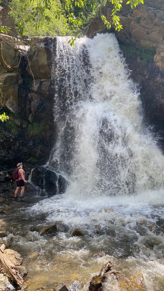
Heugh’s Canyon Falls
Heugh’s Canyon Waterfall sits in a Grotto hidden from the main trail.
If you live in the Salt Lake City area, this makes an excellent after-work hike. At only 3 miles, you’ll still find this trail to be a fun adventure as you hike through trees (wildflowers in the spring!), over a few bridges, and then scramble across a boulder field to reach the falls.
Trailhead: Park just off Wasatch Boulevard at the signed parking (you’ll need to walk through the neighborhood for a short bit to access the actual trailhead.)
Distance: 3.1 miles RT with 1,236 ft elevation gain.
Other Trail Information: Dogs Permitted. No Bathrooms at the trailhead.
Best Season: Year-round. Spring is best for wildflowers and big flows. Bring spikes in winter.
Moss Ledge Waterfall
The upper two tiers of Moss Ledge Falls.
More of a scramble than a hike, you’ll be negotiating around loose rocks and boulders for much of the “trail.” Despite the short distance from the road, these falls have three separate tiers and feel very remote. You are more likely to find solitude on this hike compared to others in the canyon.
Trailhead: Pullout by mile marker 7 in Big Cottonwood Canyon
Distance: .8 miles RT with 559 ft elevation gain.
Other Trail Information: Dogs Permitted. No Bathrooms at the trailhead.
Best Season: Summer and Fall. Do not hike in winter because of avalanche danger or in spring because high water flows make the trail dangerous.
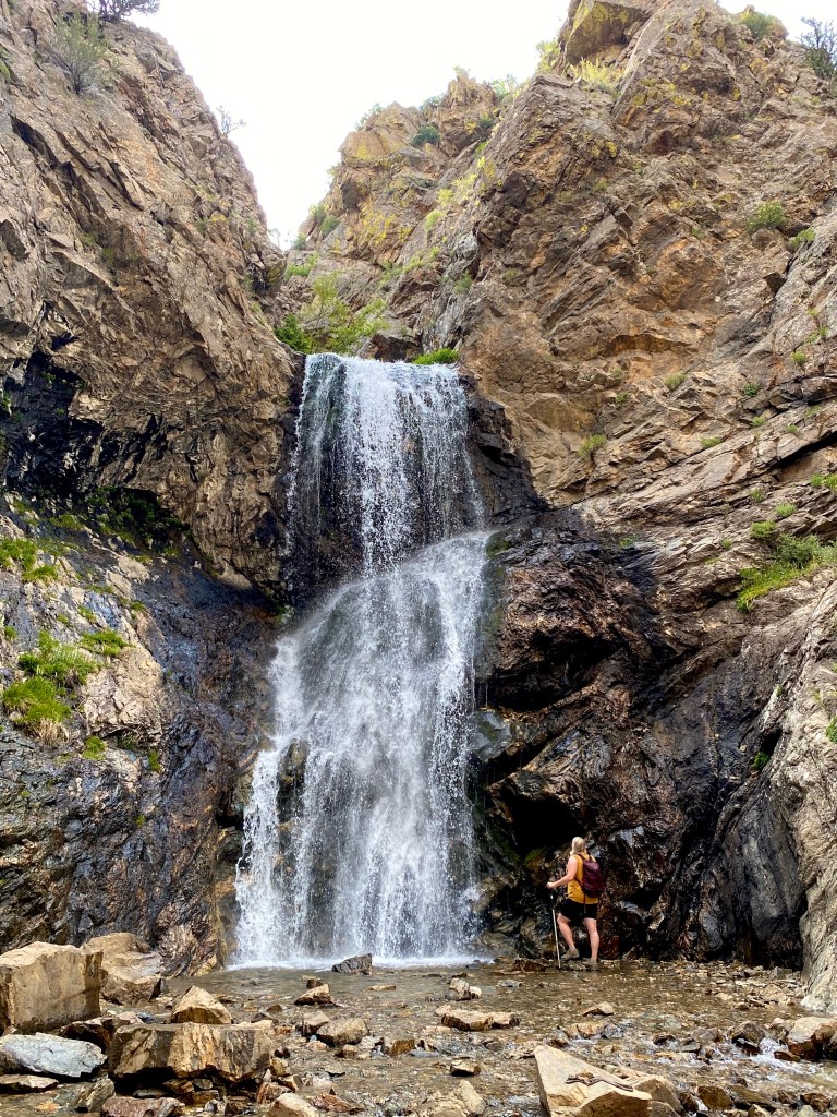
Horsetail Falls
Horsetail Falls in late summer.
The trail to Horsetail Falls is consistently steep but manageable the whole way. You’ll have a few stream crossings along with forest, mountain, and valley views. Just like the falls in upper Farmington Canyon, you’ll have a rope to finish the final descent on the trails to the falls, but this one is a lot less sketchy, in my opinion.
Trailhead: Dry Canyon Trailhead in Alpine, Utah
Distance: 4.4 miles RT with 1,695 ft elevation gain.
Other Trail Information: Dogs Permitted. No Bathrooms at the trailhead.
Best Season: Year-round. Best Flows in Spring.
Battle Creek Falls
Lacy Battle Creek Falls
This moderate but short trail is popular with both families. You’ll know you’re almost there after the wide path crosses the footbridge. After you enjoy the falls from the base, make sure you take the trail to the top of the falls for the incredible view of the valley and Utah lake below.
Trailhead: Dead End of Battle Creek Drive in Alpine, Utah.
Distance: 1.6 miles roundtrip with 606 ft. gain (for both top and bottom of falls)
Other Trail Information: Bathrooms are available in the nearby park; dogs are permitted.
Best Season: Year-round. Early spring is best for wildflowers and big flows. Bring spikes in winter.
Hiker near the base of the upper tier of Stewart Falls.
Another crowd-pleaser of a hike, this trail rolls through aspen groves and pines with views of majestic Mount Timpanogos and the Sundance Ski Resort before you round the bend to view the 200-foot, two-tiered cascade. After you enjoy the overlook, proceed down the switchbacks for an up-close view of these spectacular falls.
Trailhead: Aspen Grove Trailhead or Ride the lift at Sundance Ski resort and take their trail.
Distance: 3.4 miles roundtrip with 930 ft. elevation gain
Other Trail Information: $6 forest service fee (or free with your national parks pass),
Bathrooms at the trailhead. Dogs permitted.
Which hike is your favorite? I’d love to hear about it in the comments.
There’s something so magical about a good waterfall hike, but when the temperatures drop, there’s no need to wait to enjoy these spectacles of nature. Experiencing the majestic marvels with their frosty domes and chandelier-like icicles is just a short hike away.
If you’re new to winter hiking, please check out this Winter Hiking Tips for Beginners by Utah State Parks. It has all you need to know to prepare you for a fun and safe day on the trail. Looking for winter gear and essentials? Check out my gear.
A note to all hikers, I wore spikes on all of these hikes. You’ll need more than standard hiking shoes to negotiate the ice. Before proceeding into any of these canyons, you must also check the avalanche danger. Current conditions can be found here: https://utahavalanchecenter.org/
******This post contains affiliate links. If you click on one of them, I may receive a small commission at no extra cost to you. Thank you!
Adam’s Canyon Falls
Adams Canyon Frozen Waterfall
Located in Kaysville, just off Highway 89, you start this hike in full sun before you enter the canyon and follow the stream all the way to the falls. These falls are more reliably frozen during the winter months because of the shade in the canyon. These 40-foot falls always have interesting ice formations instead of the typical ice canopy. This is a great one for those who like to hike with their dogs.
Trailhead: Adams Canyon Trailhead
Distance: 4.2 miles roundtrip with 1,358 ft. elevation gain
Other Trail Information: no bathrooms at the trailhead. Dogs permitted.
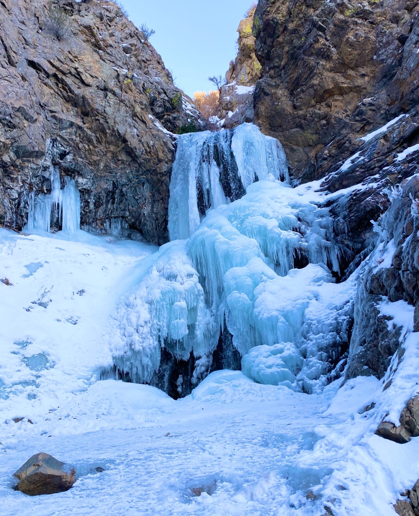
Bell’s Canyon Falls
Bells Canyon Waterfall
This trail has more than just the falls: a beautiful tree-lined reservoir comes into view after less than a mile of valley views. After you pass the reservoir and go through a meadow, you cross the creek and enter the pine-filled craggy granite canyon. The final quarter-mile climbs steeply before you are rewarded with the frozen falls opposite another beautiful view of the Oqquirh Mountains and the Salt Lake Valley. This popular trail has a new, larger trailhead lot under construction to make accessing these falls even easier.
Trailhead: Granite Trailhead
Distance: 5.1 miles roundtrip with 1,492 ft. elevation gain
Other Trail Information: Bathrooms at the trailhead.
No dogs because of the watershed.
Donut Falls
Donut Falls
This is arguably one of the most popular trails in the area for a reason. This family-friendly gem pays off with a scenic river and beautiful cascades after a relatively easy hike. Caution and experience are advised if you choose to navigate up the slippery rocks to enter and view the falls coming through the “donut hole.”
Trailhead: Mill D North
Distance: 3 miles roundtrip with 498 ft. elevation gain
Other Trail Information: Bathrooms at the trailhead. Dogs are not permitted.
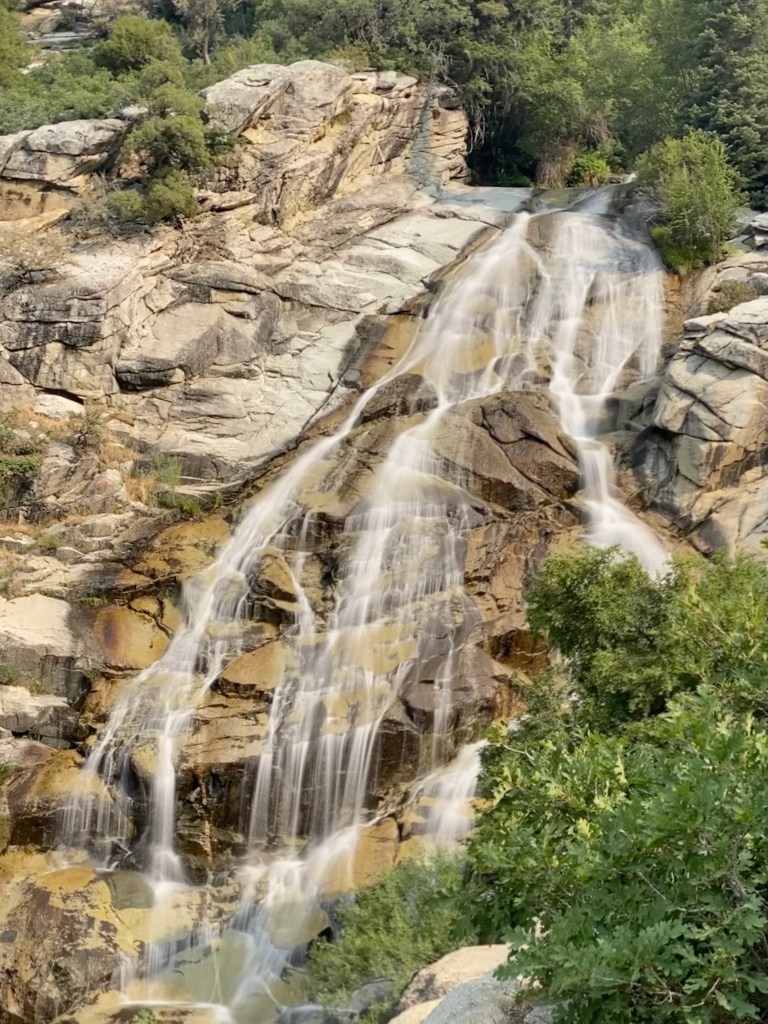
Waterfall Canyon
Waterfall Canyon Falls
Don’t let the short distance fool you, as the last half of this trail climbs steeply to the falls. It’s worth every step, however. I hiked these 200+ feet falls for the first time this year, and they might be my new favorite.
Trailhead: 29th Street Trailhead in Ogden
Distance: 2.4 miles RT with 1,100 ft. elevation gain
Other Trail Information: Bathrooms at the trailhead. Dogs permitted.
Stewart Falls
Climbers at the base of the 2nd Tier of Stewart Falls
Another crowd-pleaser of a hike, this trail rolls through aspen groves and pines with views of majestic Mount Timpanogos and the Sundance Ski Resort before you round the bend to view the 200-foot, two-tiered cascade. Don’t make the same mistake I did, and stop at the overlook. Proceed down the switchbacks for an up-close view of these spectacular falls. *These falls lie in avalanche terrain. Do NOT hike this trail unless the avalanche danger is green. Check current conditions here:https://utahavalanchecenter.org/
Trailhead: Aspen Grove Trailhead (only trailhead available in winter.)
Distance: 3.4 miles roundtrip with 930 ft. elevation gain
Other Trail Information: $6 forset service fee (or National Parks pass),
Bathrooms at the trailhead. Dogs permitted.
Farmington Canyon Falls
Standing on the ice dome at the base of Farmington Canyon Falls.
This hike is also locally known as the Car Graveyard hike because of the 6+ car wrecks that can be found hidden in the trees along the trail. They toppled from the road high above. Some of the wrecks are probably from the early 1900s. Just past the summer trailhead, you’ll encounter a small cave. You’ll come to the first creek crossing about a mile after the cave. Most of the wrecks are found after the first creek crossing (there are two crossings, both with small cascades). Make sure you follow the social trails, so you don’t miss any wrecks. Near the trail’s end, you’ll hear the falls before you see them. Going to the base of the falls requires negotiating a steep hillside with the aid of a rope. Proceed at your own risk.
Trailhead: Farmington Canyon Road Gate (in winter)
Distance: 5 miles roundtrip (winter distance) with 1,355 ft. elevation gain
Other Trail Information: No bathrooms. Dogs Permitted
Hidden Falls
Hidden Falls
This trail is accessible to most because of the distance. This hidden grotto really is a treat, so don’t miss it.
Trailhead: Mill B (right by the Lake Blanche Trailhead)
Distance: .3 miles roundtrip with 49 ft elevation gain ( I highly recommend continuing another mile to the overlook of Big Cottonwood Canyon and the Salt Lake Valley below.
Other Trail Information: Bathrooms at Lake Blanche Trailhead nearby. No Dogs
Battle Creek Falls
Battle Creek Falls
This moderate but short trail is popular with both families and ice climbers. You’ll know you’re almost there after the wide path crosses the footbridge. After you enjoy the falls from the base, make sure you take the trail to the top of the falls for the incredible view of the valley and Utah lake below.
Trailhead: Dead End of Battle Creek Drive
Distance: 1.6 miles roundtrip with 606 ft. gain (for both the top and bottom of falls)
Other Trail Information: Bathrooms are available in the nearby park, and dogs permitted
Which hike is your favorite? I’d love to hear about it in the comments.
In this Itinerary, you will find all you need for the ultimate travel adventure in the San Juan Islands. I will cover our 5-day Itinerary, but you can easily customize it to fit your time constraints and adventure level.
Highlights:
Day 1: AM: Ferry to Orcas Island, Eastsound village shops, and farmer’s market
PM: Hike to Twin lakes and kayak on Mountain Lake
Day 2: AM: Whale Watching Tour
PM: Hike Turtleback Mountain and visit Orcas Island Pottery.
Day 3: AM: Kayak tour of Sucia Island State Park
PM: Hike Cascade Falls trail and Obstruction Pass State Park
Day 4: Ferry to San Juan Island and explore beaches, farms, and lighthouses by Ebike
Day 5: AM: Explore Cascade Lake and lagoon by kayak
PM: Summit Mount Constitution, Sunset and Full Moon Kayak tour of Salish Sea
Now for the details:
Day 1: Ferry to Orcas, Eastsound, and Moran State Park
Enjoying the ferry ride from Anacortes to Orcas Island is an adventure in and of itself. We chose to take one of the first ferry rides of the day so we could maximize our time on the Island. This had the added benefit of the beautiful early morning light over the Puget Sound. Get your camera out and head out to the decks for optimal picture-taking opportunities. You may even see harbor seals, eagles, or Mount Baker!
Make sure to check the ferry schedule and make a reservation well in advance so you can guarantee your spot if you are bringing a car. We opted to rent a car and bring it with us. You can also walk on the ferry and then rent a car on the island.
Early morning light over the Puget Sound and Cascades.
Once our Ferry arrived at Orcas Island, we headed over to Eastsound to explore the village with its quaint shops and restaurants and enjoyed the Saturday Framer’s Market. This little market is flush with farm-fresh produce, the most amazing flowers, and local goods.
Next, we headed over to what I consider the crown jewel of Orcas Island, Moran State Park. With almost 40 miles of hiking trails, 5 freshwater lakes, and 4 waterfalls, you could easily spend the entirety of your visit just at this state park. If you plan to spend more than one day visiting the park like we did, make sure to get Washington’s state parks pass called the Discovery Pass. It’s well worth every penny and is good for an entire year at any park in Washington state.
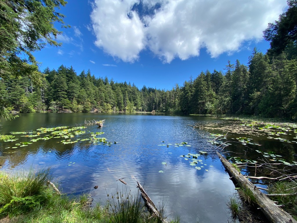
On this day, we hike around Mountain Lake to Twin Lakes. We traipsed through old-growth forest with moss, ferns, and foxglove wildflowers, then hiked up the easy grade to Twin Lakes to enjoy our lunch with a view of Mount Constitution and lily pads over the still waters.
Lunch Spot at Twin Lakes in Moran State Park
After we enjoyed our lunch, we headed back down to Mountain Lake and set up our pack rafts. These are lightweight inflatable kayaks that you can travel and backpack with. However, Orcas Adventures at the Mountain Lake campground and Cascade lake rents canoes and kayaks. We spent the rest of the afternoon exploring the coves and islands on the lake.
Cove on Mountain Lake
Day 2: Whale Watching Tour, Hike Turtleback Mountain and Visit Orcas Island Pottery
Day two was probably my favorite day of the whole trip. Observing Orcas in the wild has been a bucket list item for as long as I could remember, and the Orcas sightings around the San Jauns are practically guaranteed. As a matter of fact, many companies do guarantee sightings, or you can book another trip for free. As luck would have it, we observed these magnificent creatures for an hour on our tour. You can watch a short video of our adventure here. There are many companies you can book for this adventure. We used Deer Harbor Charters.
Orca swimming by Obstruction Pass State Park
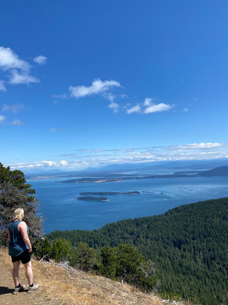
After we grabbed a late lunch back at our cabin, we headed out to hike Turtleback Mountain. Some argue that the views from Turtleback Mountain are the best in all the San Juan Island as you have the best views of the island archipelago. There are two options for Turtleback Mountain. The North trailhead to Orcas Knob is a 6 mile out and back with a 1,322 ft gain. The hike from the south trailhead is a 6.6-mile loop (1,640 ft. gain)or 2.7-mile loop (859 ft. gain) if you just want to hike to Ship’s Peak. I recommend Ship’s Peak or Orcas Knob for the best views.
View from Ship’s Peak on Turtleback Mountain
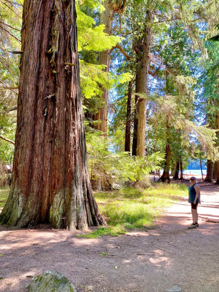
After we enjoyed our hike to stretch our sea legs, we head over to Orcas Island Pottery. This pottery studio is located on West Beach, just outside the village of Eastsound. To get to the studio, just follow the signs. Even the drive there is like entering a fairyland as you drive through old-growth cedars and Douglas firs. They sell pottery from 7 local artists in their beautiful gardens surrounded by the forest and overlooking the Salish Sea. It was enchanting. Learn more here.
Day 3: Kayak Tour of Sucia Island State Park, Cascade Falls and Obstruction Pass State Park
Today we took a Sea kayaking tour with Outer Islands Excursions to explore the waters and shores around Sucia Island. We met our guide on the dock and took a boat ride over to the island where we hopped into our sea kayaks to paddle around this beautiful place. We saw harbor seals (and their pups!), sea otters, eagles and explored remote beaches. I was pleasantly surprised that the paddling felt just like being on a lake. The water was that calm. While I know that they aren’t always as glassy as they were on this day, the waters of the Salish Sea are typically calm and easy to paddle. Although the outfitters we used did a great job, I feel like if I were to do this again, I would just rent the kayaks and do the self-guided tour. This would give us the freedom to take the time at the places we wanted to and even go a little faster than the group did so we could see explore more places around the island.
Views of Mount Baker
Secluded beach
Signature red bark madrone trees
Glassy water
We returned to Orcas Island at three which left us enough time to boogie back over to Moran State Park to hike the Cascade Falls trail. Cascade Falls is the largest waterfall in all the San Juan Islands at 40 feet tall. This short hike is only 1.5 miles with minimal elevation change where you can see four waterfalls (Cascade, Hidden, Rustic, and Cavern falls) in the ravine surrounded by ferns, moss, and old-growth forest.
Cascade Falls
Rustic Falls
Hidden Falls
Cavern Falls
Finally, we headed over to Obstruction Pass State Park to hike the Obstruction Pass trail. This 1.4-mile loop takes you through the highland forest with intermittent balds (meadow-type areas covered with moss) to a rock-strewn beach. Here is where you can observe more wildlife and enjoy a picnic by the lapping water. Ironically, this is where we saw the Orcas just offshore during our whale watching tour just the day before.
Moss covered Bald
Obstruction Pass Beach
Day 4: San Juan Island by Ebike
Orcas Island is the largest of the San Juan Islands and we feel has the most to offer in terms of outdoor adventures but on this day we planned to walk on the inter-island ferry (free!) to explore the most populous of the archipelago, San Juan, with its popular town of Friday Harbor. The ferry between Orcas and San Juan Island runs about every four hours. Make sure you consult the schedule to ensure you have as much time as you want to maximize your visit to San Juan.
After we arrived at Friday Harbor, we explored the town and shops by foot before grabbing a picnic from Spring street Deli and popping in next door at Gilligan’s Island Style Ebikes. This was definitely the way to go considering the size of the island, the hills, and the wind. We still got a great workout but were able to cover more of the island and have the energy to do some short hikes as well.
There are many different routes you can take to explore the island and Gilligan’s has maps with directions that come with your bikes so you can be confident in your exploration. I recommend either an island loop out to Lime Kiln State Park with its beautiful lighthouse and whale watching from the cliffs or the route to South Beach and Cattle Point with the beach, lighthouse, and wildlife. On both routes, you can plan on passing scenic farms (many with farm stands selling local produce and flowers), coastal views, and potential wildlife sightings.
We opted for Cattle Point which has a better shoulder and less traffic for riding. We loved enjoying the coastal views of the Olympic mountains and the waves crashing on the shore at South Beach as we enjoyed our picnic. After our picnic, we continued on to Cattle Point where we took the short hike out to the lighthouse. We saw foxes in the meadow and coastal birds soaring above the shore. On our return trip, we added on the short loop to Pear Point with its forested country roads and Jackson’s Beach.
After a full day riding, we hopped on the five o’clock ferry and got back to Eastsound in time for a lovely dinner at Kingfish overlooking West Sound watching the sunset. A positively dreamy end to our day.
South Beach
Cattle Point Lighthouse
Coatsal Views from the bike
Day 5: Summit Mount Constitution, Explore Cascade Lake and Lagoon by Kayak, Sunset and Full Moon Kayak Tour of Salish Sea
We had a final action packed day on the island. We began the morning by heading back to Moran State Park to kayak on Cascade Lake over to its freshwater lagoon. Cascade Lake has a small beach area, playground, picnic area, snack shop, and Orcas Adventures which has all you need to get out on the water for the day if you don’t have your own boat to paddle. Not only was Cascade lake a great place to paddle but there is a trail around the lake that many use to access the bridge between the lake and lagoon for bridge jumping. The lagoon’s still water made the perfect location for lily pads and all sorts of waterfowl to observe on the water.
Lagoon Lily Pads
Old Growth Near Lake Cascade
Lagoon Bridge
After we had our fill of the lake we drove part way up Mount Constitution and began our hike at the Little Summit trailhead. This hike allows for views both at Little Summit and at the top of Mount Constitution. This hike is 5.9 miles round trip with almost 1,000 feet of elevation gain. It’s a gorgeous hike through an old-growth forest with occasional breaks in the trees for views. Mount Constitution has a tower on the summit. Don’t miss the views from this point with the interpretive signs to tell you everything on the horizon.
Tower views of Puget Sound and Olympic Peninsula
Little Summit Views
Moss and Old Growth
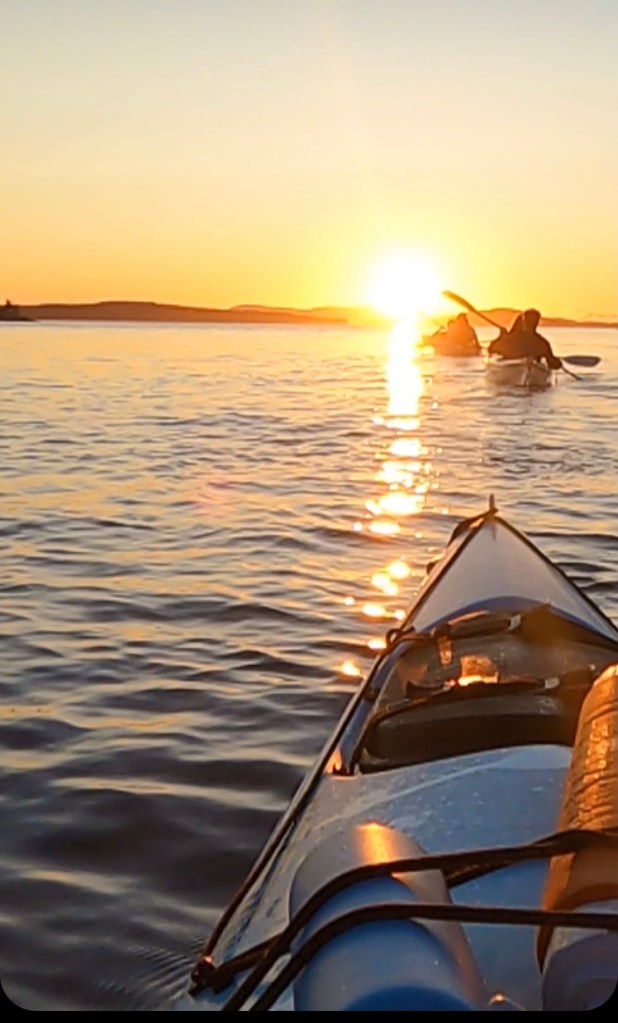
We ended the day with a sunset and full moon kayak tour out of Deer Harbor with Shearwater Kayak Tours. I can’t think of a more perfect way to end our time on the island watching the golden sunset over the glassy waters and the full moon rise. We got to see a ton of harbor seals and their pups on the shores of some of the tiny islands we paddled around, in addition to the sunset. Watch a short video here. This was the dreamiest, so if you are fortunate enough to time your visit with the full moon run, don’t walk, to make a reservation. I promise you won’t regret it.
Sunset over the Salish Sea
Are you ready to book your trip to Orcas Island? Hopefully, you have all you need to plan your perfect adventure. Feel free to reach out in the comments or by sending me a message. I’m always happy to help craft your perfect itinerary!